 SORANO
The town of SORANO (374 m above sea level) is located in the hilly area of the Maremma grossetana, near a spectacular crossroads of three deep volcanic gorges, which wind tortuously down from the northern side of Lake Bolsena.
The town is about an hour’s drive from Mount Amiata, Orvieto, Tarquinia, the Argentario, Tuscania and Viterbo. With about half an hour’s drive you can reach Lake Bolsena, Saturnia, Montemerano, Farnese and Acquapendente. The landscapes around Sorano are dominated by eroded and towering cliffs of volcanic tuff, veined with yellow, ochre, grey and red. The rocky hills rise with their unreal silhouettes over precipices and gorges, up to a hundred meters high, where the cold waters of streams flow on the valley floor, converging into the main local river, the Fiora, the Etruscan Armine.
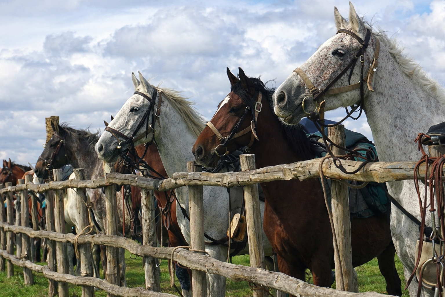
The village boldly overlooks the surrounding tufa cliffs, covered in dense Mediterranean scrub, predominantly holm oaks, oaks, turkey oaks, ashes and chestnut trees. This uncontaminated woodland habitat is a refuge for numerous animal species, rare or endangered: buzzards, porcupines, badgers, river crustaceans, otters, resident and migratory birds. In the shady undergrowth and on grassy clearings, renowned valuable plants (orchids, ferns, maidenhair fern) and a wide variety of fungal species (porcini, amanita, chanterelles, truffles) thrive. Sorano, in the heart of ancient Etruria, together with Sovana and Pitigliano, is among the major and most ancient rock settlements of the middle Fiora valley, already a seat of settlements of the first Italic civilizations since the Bronze Age (2000 BC).
Like other towns in the Maremma grossetana, Sorano was occupied in the early Middle Ages by the Longobard lineages of Lucca, from which most likely descended the Aldobrandesco lineage that dominated for at least three centuries. They were followed in the 13th century by the Counts Orsini of Rome. At the dawn of the 17th century, the Medici took possession of these lands until, in the middle of the following century, the Lorena had Sorano annexed to the Grand Duchy of Tuscany. The military and strategic importance of Sorano, which was exceptionally equipped with a large fortress and three supporting fortifications, stemmed from the need to defend what was for a long time the turbulent border between the Longobard State and the Papal State.
THE HILLS (I POGGI)
The town is laid out on a steep and wide tufa cliff. In front and around it are five rocky hills that form an impregnable and strategic bulwark, controlling the pass that led beyond the northern borders of the Fiora valley. The first, towards the west, is Poggio Rotondo: a modest rocky height of roundish shape, on whose stony surface the remains of an eroded and ancient structure, perhaps templar, from the protohistoric or Etruscan era can be recognized. The second hill is Poggio S. Rocco, whose name derives from that of the patron saint of Sorano. The site is home to a vast Etruscan rock necropolis. Numerous are the tombs carved into the rock, many of which were reused over the centuries and transformed for various purposes (deposits, warehouses, stables…). In the initial part, next to the Romanesque church dedicated to S. Rocco, are the entrances to two Etruscan cave roads (vie cave), paths excavated and cut into the rock, like deep and shady underground corridors. Their peculiar structure of cyclopean dimensions and the fact that they are contiguous to each other suggest that, originally, they were built as sacred paths connected to the local necropolises, and therefore had a particular magical-sacral function. After the Etruscan civilization ended, the cave roads were reused as actual roads to connect Sorano with the surrounding hills and countryside. The next hill after S. Rocco, called Le Rocchette, has the same characteristics: ancient protohistoric and Etruscan site, with remains of cave roads, necropolises, dovecotes (colombai) and subsequent fortification (incastellamento) in the medieval era. The other two hills are Castellaccio and Castelvecchio. The latter is of particular interest, especially for the large caves at the top, of remote origins, probably Etruscan. Castelvecchio is an elongated rocky crest, surmounted by spires and natural peaks. In this site, in the shade of a small holm oak wood, are the remains of a fortification, with walls, cisterns, wells and various rooms, of presumed Longobard origins.
 PITIGLIANO
The most unique medieval center of Southern Tuscany, it appears in all its extent immediately after a curve in the locality of Corano. The town of Pitigliano is located km. 85 from Grosseto; km 61 from Viterbo, km 19 from Manciano. It is 313 meters above sea level. The most interesting monuments are: the remains of the Etruscan walls, the bastioned fortress of the Cittadella (year 1545); the ancient Aqueduct with its 15 arches; the church of San Francesco; the Orsini palace (from the 14th and 15th centuries) with a 15th-century well and portal inside. The Duomo, with a Baroque facade, is medieval with several reconstructions. In the small square in front of the Duomo, a beautiful pillar with the emblem of the Orsini (year 1490) can be seen. Inside the late Renaissance church of S. Maria, coats of arms and frescoes are preserved. In the 1600s, a large community of Jews settled in Pitigliano, of which many testimonies remain today: besides the Synagogue, there is the Cemetery, the bakery for unleavened bread (forno degli azzimi) and the ghetto. The Synagogue (late 16th century), once dilapidated, has been reopened for worship by the very few remaining Jews, heirs of the large colony that for centuries lived and thrived alongside the Christian population. At the Pitigliano social winery, where an excellent D.O.C. white wine is produced, the wine destined for Jews is also bottled. Among the festivals we remember the Grape Festival (Festa dell’Uva), associated with the religious one of the Madonna delle Grazie which takes place during the first week of September. Among the typical products are the Christmas biscuits called “Sfratti” and aniseed biscuits. A characteristic dish is Buglione: lamb cooked with bread and garlic. You leave Pitigliano by going in the opposite direction on the state road 74 for no more than 1 km. The turnoff for Sovana is right under the tufa ridge that supports the town of Pitigliano. Sovana is about 7 km away.
 THE ORSINI FORTRESS
This is the major medieval and military fortification in the Tuscan Maremma. During sieges and battles, the Fortress was backed by three minor castles, located on three hills opposite Sorano: Le Rocchette, Castellaccio and Castelvecchio. This position defended the pass towards Orvieto, Siena, Chiusi and the interior of the peninsula. The purely strategic position of the fortress meant that these lands long became the theater of inevitable conflicts, sieges and wars, so that Sorano earned the nickname “zolfanello d’Italia” (little sulphur match of Italy), without its fortress ever being conquered. On the high cliff where the Fortress stands today, the acropolis, i.e., the fortified area, was built in the Etruscan age, on the highest and therefore most sacred site. Also on the same site, a first “incastellamento” was built, of probable Longobard origins, until the first fortress was built in the 13th century by the Aldobrandeschi, Lords of the county of Sorano, Pitigliano and Sovana. Finally, in 1552, the castle was enlarged by Count Niccolò IV Orsini. The original layout, still firmly preserved, presents an imposing structure enclosed within long perimeter walls, with overlying ramparts, and two large corner bastions, east and west, surmounted by the sculpted coats of arms of the Orsini. The coat of arms above the main entrance, to the south, bears the insignia of the Aldobrandeschi (the rampant lion) and the Orsini (the roses, the transverse bands and the osro?). The fortress consists of two parts: the Keep (Mastio), the parade ground and the gunpowder magazine (santabarbara), surrounded by walls and various rooms for military use; after crossing the second artificial moat, one enters the residential quarter, perhaps older, where the castellans lodged. Of great interest are the so-called “mines”, the long walkways inside the walls that lead to the underground levels of the fortress. Here, air arrives through dizzying air intakes connecting the underground to the upper ramparts. The castle was also equipped with forges, an oil mill, food stores, cisterns and wells for water. In the residential part (Piazza Cairoli) the architecture is embellished by a Renaissance loggia with three arches, overlooking the valleys and roofs of Sorano. Next to the loggia are the Comitale Palace, residence of the Count Orsini, a small church and other period dwellings. Also in Piazza Cairoli is the entrance to the Medieval Civic Museum.
 SOVANA
It is the smallest but also the most intact medieval village in the hilly Maremma. The town preserves its original medieval layout, characterized by the brick floor (herringbone pattern), the soaring Aldobrandesca Fortress, and numerous period buildings, embellished with heraldic coats of arms of the Medici, Orsini and Aldobrandeschi. The proto-Romanesque church of S. Maria, in Piazza del Pretorio, besides numerous Renaissance frescoes, possesses a 9th-century ciborium, unique of its kind, finished with precious ornamental and symbolic bas-reliefs. The most important religious building is the monumental Duomo of S. Pietro (12th century), built with elements of Romanesque architecture, together with others in Gothic style. The Etruscan Suana (or Suama) still preserves a very rich heritage of monumental necropolises, created with a refined sculptural technique directly on the tufa cliffs. In the Sovana valley, bathed by three watercourses, chamber tombs (cube and semi-cube), temple tombs (Tomb of Ildebranda), dovecote tombs, and aedicula tombs (Tomb of the Siren) have been found. Beside the necropolises descend the routes of deep cave roads (il Cavone, the via cava of S. Sebastiano, the via cava of Poggio Prisca), on whose high walls inscriptions and sacred symbols are carved.
 MANCIANO
Manciano (at 444 m above sea level) is a town characterized by its agricultural activity. Cheeses (among these, the prized “pecorino toscano” produced by the Manciano Social Dairy). Sales points for local products are scattered almost everywhere in the main streets of the town. The Dairy’s shop is located up high, just outside the city walls at Porta Fiorella. The town preserves, in the upper part, the ancient urban nucleus with a maze of alleys leading to the ancient Rocca (fortress), today the seat of the Town Hall and the Museum of Prehistory and Protohistory of the Fiora Valley. An art gallery exhibits, among other things, the works of fellow townsmen Pietro Aldi and Paride Pascucci. In the few kilometers – about 19 – of the S.S. 74, which separate Manciano from Pitigliano, we notice an unexpected change in the landscape: the usual landscape of the Tuscan hills gives way to a world made of tufa plateaus, vast plains with towns that seem like mirages as the road loses itself in the ups and downs of canyons carved by the river Lente and the stream Meleta. Along the Manciano-Pitigliano route (at km 9), near the bridge over the river Fiora, it is possible to take a detour onto a dirt road for a few kilometers – a walk is recommended to visit the Etruscan necropolis of Poggio Buco-Sparne.
 MONTEMERANO
Montemerano (at 303 m above sea level) is a medieval village whose origin dates back to 1188, located at the intersection of the state road that goes towards Manciano and the provincial road, called the “Follonata”, which leads to the Terme di Saturnia and the town of the same name. It is a town, whose fame is due to the progressive return of tourists who combine a pleasant stay in this Tuscan town with visits to the thermal baths and archaeological zones. A stop is a must to visit the church dedicated to S. Giorgio (year 1380). Numerous are the works of the Sienese school. Note, on the altar of the Assunta, the “Madonna della Mandorla” by Lorenzo di Pietro known as “Vecchietta” and, by the same author, a beautiful wooden statue depicting St. Peter. By Sano di Pietro, the “Madonna with Child and saints”. The most famous work is the “Madonna della Gattaiola” placed on the right side of the high altar. The Terme di Saturnia (172 km from Rome and 170 km from Florence and 65 km from Grosseto) are 5 km from the junction of the Scansano-Montemerano road along the “Follonata” provincial road. The hotel complex of the Terme, open all year round, allows tourists to use, even for a few hours, some services including swimming in the pool. The thermal baths were already known since the time of the ancient Romans. Its waters gush out at a speed of one cubic meter per second at a temperature of 37.5 degrees and are particularly indicated for many skin diseases, diseases of the female genital tract, for osteoarthritis and peripheral vascular diseases, for rheumatism in general, for uricemia and gout. Suggestive are the thermal waterfalls (identical to that of the Terme because it springs from the same source) in the locality Gorello, called precisely the “Cascata del Mulino” (Mill Waterfall – free access). Along the road that separates Montemerano from Manciano (about 6 km) you encounter a small cluster of houses called Poderi with excellent restaurants serving typical Maremma dishes.
THE ANCIENT VILLAGE (IL BORGO ANTICO)
The main entrance to the historic center is after Piazza Busatti, at a vaulted entrance that introduces an atmosphere of times past, where the road system is still medieval, with narrow alleys, stairways descending towards the edge of the cliff. A few meters from the entrance is the church of S. Niccolò, of quite ancient origin (11th century), subjected to restorations and reconstructions over the centuries. Inside, a singular altar, consisting of a single block of rough tuff. The church also possesses a seventeenth-century crucifix, donated by Cosimo III de’ Medici, and a sixteenth-century baptismal font. Immediately next to the church is the Comitale Palace, residence of the Orsini counts, outside the fortress walls. The palace is an elegant Renaissance noble building: a finely crafted terrace loggia and the underlying portico overlook a cozy internal courtyard, where a staircase leads to the upper apartments. The southern side of the town, still being restored, is where traces of the most remote eras are visible: rock caves and other rooms carved into the tuff stand alongside medieval buildings and reworked Etruscan tombs until, on the outer edge of the cliff, you reach the entrance to a curvilinear and wide gallery, of presumed Etruscan workmanship, leading to the river Lente. In the middle of the historic center rises a massive and elongated tufa cliff, reinforced with reinforcing walls by Leopold of Lorraine in the eighteenth century: it is the Masso Leopoldino, a natural height which, before the Lorena, rose like a pointed hill overlooking Sorano, probably already the site of an ancient sacred place of the Etruscans. Descending towards the northern side, you cross the ancient alleys that lead to the medieval Porta dei Merli, a massive tuff portal, covered with travertine, built to allow entry into Sorano from the valley floor. At the top of the door are affixed the heraldic coats of arms of the Orsini and the Medici. Leaving Sorano by this route, you enjoy a vast panorama, from below, of the deep gorges, woods and rocky hills that surround the valley.
 VITOZZA
Near S. Quirico, a few kilometers from Sorano, lies the ruined city of Vitozza, probably destroyed by the Sienese in the 15th century. The site is of considerable interest for the incredible number of caves and hypogea (over two hundred), made from the Bronze Age through the Etruscan and Roman periods, and finally throughout the Middle Ages. Among the remains of the medieval settlement, the ruins of three fortifications stand out, each equipped with an artificial enclosing moat. Of two ancient churches, the walls remain standing: the so-called “Chiesaccia” and the church of S. Angelo, which you reach after a short cave road (via cava). On the southern slope of Vitozza is a valuable dovecote (colombaio), from the Etruscan-Roman era (1st century BC). A lush coppice woodland gives the site a special naturalistic beauty.
 CAPALBIO
It was an ancient domain of the Abbots of Tre Fontane and then of the powerful Aldobrandeschi family, who surrounded their possession with strong walls and built a powerful fortress. Driven out in 1212 by Ugoforte, lord of Fondi, the Aldobrandeschi returned to Capalbio with Ildebrandino known as the Red Count (Conte Rosso). Subsequently, the towered village (Borgo turrito) briefly belonged to the Aldobrandeschi, who in the 14th century sold the castle to Count Guidone of Sovana of the Orsini family; then the inhabitants gave themselves to the Republic of Siena and when it was forced to yield to the superior forces of Florence, the well-fortified Maremma fortress also passed under Medici domination. Visiting Capalbio means taking a leap into the Middle Ages, going back centuries, as it has indeed preserved the double walls, the patrol walkway (cammino di ronda), the towers and the beautiful and powerful fortress. Capalbio became a Municipality again in our century, after being aggregated in the 1700s to Manciano and in the 1800s to Orbetello.